It’s official – our Employee Spotlight series is a hit! We appreciate the feedback on our regular feature that acquaints you with both an ARRO team member, and a nonprofit in which they – and now ARRO – support. Our third spotlight falls on Andrew Tuleya, a GIS Manager/Analyst IV and drone operator for ARRO Consulting, who works in our Lititz office.
> Where do you call home?
It’s been Ephrata since 2014. My wife, son, and I love Lancaster County. My son is currently in middle school and plays basketball and soccer year-round. I grew up in the area as well in York. In my spare time, I am usually doing yard work, attending a sporting event, or taking my three dogs on one of their three daily walks.
> Where did you go to school? What did you study?
I went to West Chester University, where I majored in Geography/Planning with a focus on Geographic Information Systems (GIS). I also had an internship at a firm in Berwyn doing GIS during my junior and senior years. As early as my junior year in Central York High School, I began studying GIS/Technology through a program with a local technical center for students in York.
> What brought you to ARRO?
My previous company shifted their operations to the west coast, and I wanted to apply my skill set to a local firm. I had never heard of ARRO, but I was impressed right from the start at my first interview. That was in the autumn of 2019.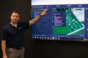
> A nonprofit which you support is the Horse-Shoe Trail Conservancy. Can you share a few details on what they do?
It’s a non-profit volunteer organization that dates back to 1935 that maintains and preserves the Horse-Shoe Trail for hikers and equestrians. The trail itself is 140-miles long, begins in Valley Forge National Historical Park, and winds through Montgomery, Chester, Berks, Lancaster, Lebanon, and Dauphin counties. It ultimately intersects the Appalachian Trail at its end point.
> Can you share a few details on what you do there as a member of their board of directors?
We meet quarterly to discuss on-going trail maintenance projects, identify new easement and property access opportunities, review information received by the public, review the budget, and address website needs (I maintain the site).
I particularly enjoy applying my professional skills when maintaining the master trail layer in GIS as new sections of trail are added or removed. My experience piloting a drone often comes in handy.
> What led you to support the Horse-Shoe Trail Conservancy?
My passion for the outdoors, physical activity, and mapping enables me to contribute to helping our dedicated board members maintain the trail for the public to use and enjoy.
> ARRO is excited to support their mission with a donation. What are a few ways monetary donations are used there?
It will be used one of two ways: maintenance funds are used for re-routes, erosion controls (geo cell, stone), and to purchase equipment like mowers, weed whackers, etc. Preservation funds on the other hand are used to acquire easements to permanently protect the trail.
Learn more about the Horse-Shoe Trail Conservancy and how you can support them at https://cart.hstrail.org.