ARRO’s use of drone technology has greatly pushed the limits of what we can deliver to many of our clients, as well as how we can deliver it.
Just a few examples of these deliverables include:
- Stormwater management facility inspections
- Post storm conditions
- 3-D site renderings (for both overhead and 360-degree views)
- Project site conditions for pre and post work analysis
- Documentation of “hard to reach” locations (stormwater and wastewater infrastructure inspections, water tower and roof surveys, transportation corridors, etc.)
- Utilization of captured data into maps, plans, and other project deliverables
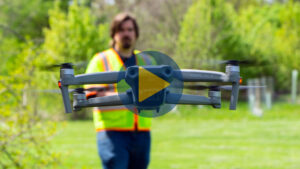
In the video below, Andrew Tuleya (GIS Manager/Analyst V) and Collin Fox (Scientist II) explained the many advantages of this service, and how it truly stretches the limits of what we can provide our clients.